


OMAN [Middle East Desk]: Two newly identified oil slicks in the Gulf have heightened fears of mounting environmental damage as maritime tensions between Iran and the United States continue to disrupt one of the world’s most strategically important waterways.
Satellite imagery and verified video footage show separate slicks in Iranian waters near Qeshm and Sirri islands, adding to growing concerns over marine pollution at a time when a major oil spill off the coast of Oman is already unfolding.
The larger environmental emergency remains centered off Oman, outside the Strait of Hormuz, where the grounded tanker Caroline Bezengi has been leaking Russian crude into a protected marine area. The spill has created an oil slick estimated by some assessments to cover nearly 2,000 square kilometres. Authorities have said that incident is not linked to the ongoing regional conflict.
The newly observed slicks, however, are located inside the Gulf.
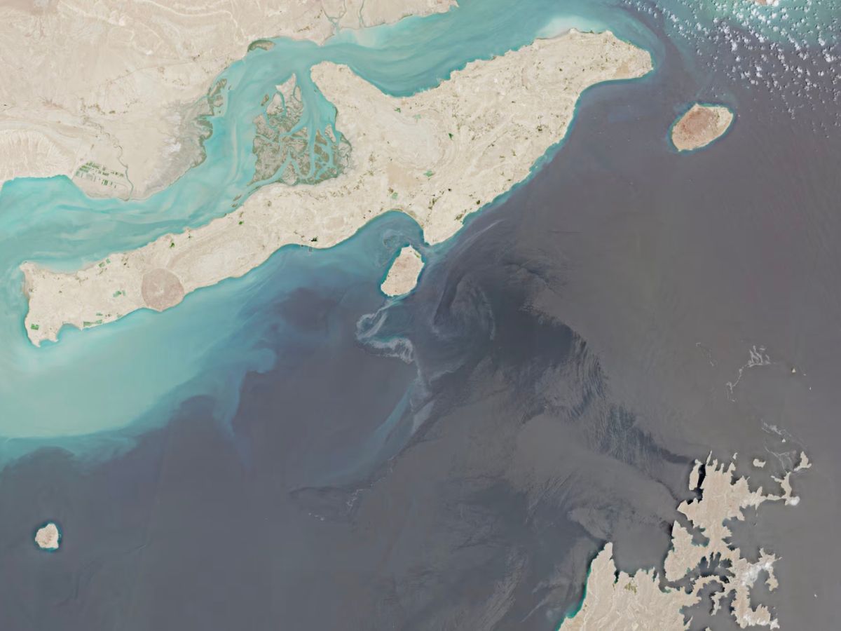
Satellite images captured by the European Union’s Copernicus Sentinel-2 mission revealed one slick extending from the southern coast of Qeshm Island, the dolphin-shaped island that sits along Iran’s shoreline near the Strait of Hormuz.
According to Wim Zwijnenburg, an environmental open-source researcher with Dutch peace organization PAX, darker sections of the slick suggest the presence of heavy fuel oil, while a lighter, more dispersed layer appears to stretch for roughly 160 kilometres.
Video recorded on August 11 and independently verified showed a dark, bubbling substance washing onto beaches near Suza on Qeshm Island, standing in stark contrast to the surrounding turquoise waters.
John Amos, chief executive of satellite monitoring organization SkyTruth, described the spill as the largest he has observed in months.
“This is the biggest one that I’ve seen in recent months, really since the conflict between Iran and the U.S. began,” Amos said, calling it “a major incident.”
A second slick was identified near Sirri Island, approximately 100 kilometres southwest of Qeshm in the central Gulf. The island hosts Iranian offshore oil and gas infrastructure. The satellite images of Qeshm were captured on August 10, while imagery of Sirri Island was taken on August 13.
Maritime analysts believe the spill near Qeshm may have originated from the Liberia-flagged dry bulk carrier Minoan Pioneer. Samir Madani, co-founder of vessel monitoring platform TankerTrackers.com, said the vessel likely leaked fuel after being damaged.
The Minoan Pioneer was struck by an unidentified projectile near Oman’s coast on August 3 during what maritime security sources described as a suspected Iranian attack while the vessel was transiting the Strait of Hormuz. One crew member remains missing. A maritime security source familiar with the incident said the same leak likely reached the shores of Qeshm Island.
Iranian Foreign Ministry spokesperson Esmaeil Baqaei said in a post on X that oil pollution had reached Qeshm Island and that preliminary evidence pointed to a foreign bulk carrier as the source.
The precise origin of either slick, as well as the substances involved, has not been independently confirmed. A source involved in salvage efforts for the Minoan Pioneer said a tugboat sent to secure the vessel had been unable to reach it because permission from Iranian authorities had not been obtained. The source requested anonymity due to the sensitivity of the operation.
Iran’s mission in Geneva did not immediately respond to requests for comment. Scientists warn that continued delays in containing the spills could significantly worsen environmental damage across the Gulf.
Brian Barnes, a satellite oceanographer and research assistant professor at the University of South Florida, said the regional conflict has complicated efforts to inspect affected areas and launch cleanup operations.
“The longer that the oil is leaking into an environment, the more it can spread out and cause damage to ecosystems, coastlines.”
Also read: India rice exports expand as groundwater crisis intensifies across farming regions